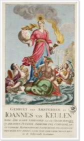
Atlases from the Maritime Museum > Johannes van Keulen
 From 1681 onwards, the Nieuwe Lichtende Zee-Fakkel appeared, a five volume atlas for which the maps had been compiled by Vooght.
The first volume contained maps of the North Sea, the Zuider Zee, and the coasts of Denmark and Norway up to Archangel in the north of Russia, and from the Baltic and the Finnish Gulf to St. Petersburg.
The second volume contained maps of the western shipping routes, from the Channel, along the coasts of France, Spain and Portugal to the Strait of Gibraltar.
The third volume held maritime maps from the Mediterranean and the Strait of Gibraltar up to the Turkish coast. These three volumes were important for ships trading in European waters.
The fourth and fifth volumes contained maps of Central and North America and the West African and Brazilian shipping routes, important to the Dutch West India Company and the shipping trade in the Caribbean.
When the five volume work was ready, Van Keulen could pride himself in being the publisher of the best updated maritime atlas available at the time.
