Atlases from the Maritime Museum
A collection of the Scheepvaartmuseum
 In the seventeenth century cartography in the Netherlands flourished. Dutch cartographers dominated almost the entire European market. This collection contains two cartographic highlights to be viewed in full, a land atlas and a maritime atlas.
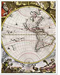
The Atlas Van Loon is a beautifully bound, extended version of Joan Blaeu's ‘Groote Atlas’ ('Large Atlas') from 1663-1665. Blaeu's Atlas comprised the entire known world at the time. In addition, the Atlas Van Loon contains Blaeu's town books and two maritime atlases by other cartographers.
Johannes van Keulen's Zee-Fakkel ('Sea Torch') – published in many editions between 1681 and the end of the eighteenth century – contained in six volumes all the maps a sailor could ever need. Almost all the maps are coloured in by hand.
