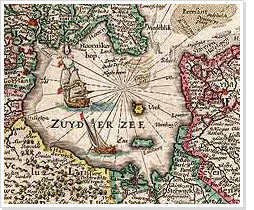
Atlases from the Maritime Museum > Joan Blaeu and his 'Grooten Atlas'
 The most noted Dutch cartographer from the Golden Age was Joan Blaeu. The finest, most extensive atlases from that period were all made by Blaeu. Blaeu mapped and made available in print the entire known world at that time.
The highlight from Joan Blaeu's production is the Grooten Atlas. This atlas gives a complete overview of the known world at the time, in - depending on the language it was published in - nine to twelve substantial folio volumes. For wealthy seventeenth-century patricians such an atlas was a coveted possession. Not only because it enhanced their social status, but also because the atlas embodied their pride in their achievements in trade and shipping. The whole world could be surveyed here in Dutch maps.
Although the necessary materials must undoubtedly have been available to him, Blaeu did not publish an atlas with maritime maps. Other publishers did. Blaeu did publish a series of Italian town books, though, which illustrates his love for Italy and his special interest in the country.
