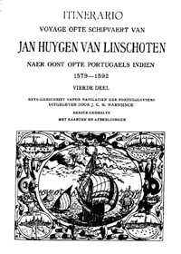
Van zeehelden en avonturiers: reisverhalen uit de 16e en 17e eeuw > Jan Huygen van Linschoten
In december 1583 vertrok Jan Huygen van Linschoten (1563-1611) naar Spanje om zich daar verder te bekwamen in de koopmanskunst. De commerciële ambities van de avontuurlijk ingestelde Haarlemse notariszoon reikten echter veel verder dan de grenzen van het Iberisch Schiereiland. In zijn jacht naar fortuin kreeg hij het vertrouwen van de aartsbisschop van Goa, waardoor hij als eerste Nederlander inzicht kon krijgen in het enorme koloniale rijk dat Portugal in het Verre Oosten had opgebouwd. Teruggekeerd in Nederland verkocht Van Linschoten zijn reisverhaal aan de Amsterdamse uitgever Cornelis Claesz, die het in 1596 in een prachtig met kaarten en prenten geïllustreerd boek publiceerde. Het Itinerario is meer dan een reisverhaal alleen: naast het relaas van de omzwervingen van de auteur op de Azoren, in Portugal en Indonesië zijn in het boek ook twee andere werken van Van Linschoten opgenomen: de Beschryvinghe van de gantsche custe van Guinea en het Reys-gheschrift vande navigatien der Portugaloysers in Orienten.
De betekenis van dit eerste Nederlandse overzichtswerk over Indië ligt in de waardevolle zeilaanwijzingen waarop Van Linschoten de hand had weten te leggen: informatie die alleen in de geheime Portugese bestuursarchieven te vinden was en die hij, misbruik makende van het vertrouwen dat in hem was gesteld, blad voor blad had gekopieerd. Zo kwam in één keer de door de Nederlanders zeer gezochte zeeroute naar Indië en tussen de Aziatische zeehavens onderling binnen handbereik. Te meer omdat Van Linschoten ook in het bezit was gekomen van delicate nautische gegevens over de stromingen, dieptes, eilanden en zandbanken, kennis die voor een veilige navigatie absoluut noodzakelijk was. Alles werd bovendien verduidelijkt met kustprofielen en kaarten die voor die tijd ongekend nauwkeurig waren.
Door onderzoek, studie en oefening hadden de Nederlandse stuurlieden zich op de grote vaart naar het Verre Oosten voorbereid. Al vanaf 1580 waren er verschillende buitenlandse handboeken in vertaling beschikbaar gekomen, waarin de navigatietechniek op de oceaanvaart tot in details werd uitgelegd. Ook cartografisch waren de horizonten verruimd. In een tijdsbestek van nauwelijks tien jaar werd het nautisch domein van de Nederlandse stuurman geperfectioneerd en uitgebreid tot de Middellandse Zee en het gehele gebied tussen de Canarische Eilanden en Rusland. De publicatie van het Itinerario in 1596 voegde een ontbrekende schakel toe: een echte vaar- en handelsroute naar Indië. Een handelsrijk overzee was het gevolg.
