Surinam mapped out > Maps
 A few hundred pages with maps of Surinam and Guiana are on view, ranging from around 1600 to the present day. These pages are partly on loan from the Koninklijk Nederlands Aardrijkskundig Genootschap (Royal Dutch Geographical Society).
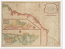
The first maps of the Guiana region were no more than rough outlines. The land between the Maroni and Courantyne rivers was surveyed from about 1660 onwards. Plantations lying along the main rivers were mapped in detail, both as single units and in groups. These land surveys helped to elaborate major general maps of the whole of Surinam, such as De Lavaux’s map (1737), Van Sijpesteijn’s map (1850) and Cateau van Rosevelt’s and Van Lansberge’s map (1882). These maps focus on the north coast region. Many plans of the capital Paramaribo have been made through the centuries.
In addition to maps of the land, there was a need for charts of the treacherous shallows off the shore and the river estuaries. Beside, there are thematic maps covering aspects such as the composition of the soil, its cultivation, agricultural and mineral produce and geology.
Finally, topographic maps began to be made in the third quarter of the 20th century on the scale 1:100.000 for the whole of Surinam and 1:40.000 for the northern part, under the direction of the Centraal Bureau Luchtkartering (Central Bureau for Aerial Survey).
View the objects:
De Lavaux
Cateau van Rosevelt en Van Lansberge
